Yonglu 雍錄 "Records of Yong" is an early local gazetteer of the region of Yong 雍 that is located around modern Xi'an 西安, Shaanxi. The 10-juan long book was compiled by the Southern Song-period 南宋 (1127-1279) scholar Cheng Dachang 程大昌 (1123-1195), courtesy name Taizhi 泰之, from Xiuning 休寧 (today in Anhui).
For his gazetteer, the writer Cheng Dachang made use of earlier books on the region, from the Han-period 漢 (206 BCE-220 CE) book Sanfu huangtu 三輔黄圖 to Tang-period 唐 (618-907) books like Tang liudian 唐六典, Chang'an zhi 長安志 or Chang'an tuji 長安圖記, as well as records of the imperial archives in Lin'an 臨安 (modern Hangzhou 杭州, Zhejiang). The book was finished during the Shaoxing reign-period 紹興 (1131-1161).
The region Yongzhou 雍州 is first mentioned in the chapter Yugong 禹貢 "The tribute of Yu" of the Confucian Classic Shangshu 尚書 "Book of Documents", where the nine provinces (zhou 州) of China are categorized concerning tax tributes. During the Han and Tang periods the region was commonly called Guanzhong 關中 "Within the Passes". When Cheng Dachang compiled his book, the region was already occupied by the Jurchen empire of Jin 金 (1115-1234).
The book Yonglu describes the history of the region, from oldest times, when the capitals Qishan 岐山, Feng 豐 and Hao 鎬 were located there during the Zhou period 周 (11th cent.-221 BCE), the capital Xianyang 咸陽 under the Qin 秦 (221-206 BCE), and its many palaces and canals, the Tang-period gardens, palaces, citygates and parks, landscape, the local administration in commanderies (jun 郡) and districts (xian 縣), temples and shrines, important events and eminent persons, Buddhist and Daoist monasteries, military garrisons, academies, granaries, and much more. The book is enriched with more than 20 maps.
 |
|
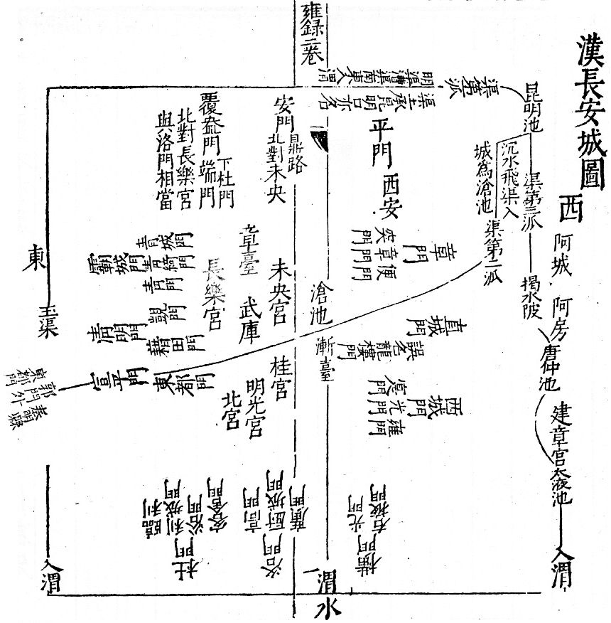
Figure 1. Drawing of Han-period Chang'an, showing the relative location of palaces, gates, canals, and River Wei. Seen from the north. Siku quanshu edition, with the commentary of Wu Guan 吳琯 (b. 1546). |
|
 |
|
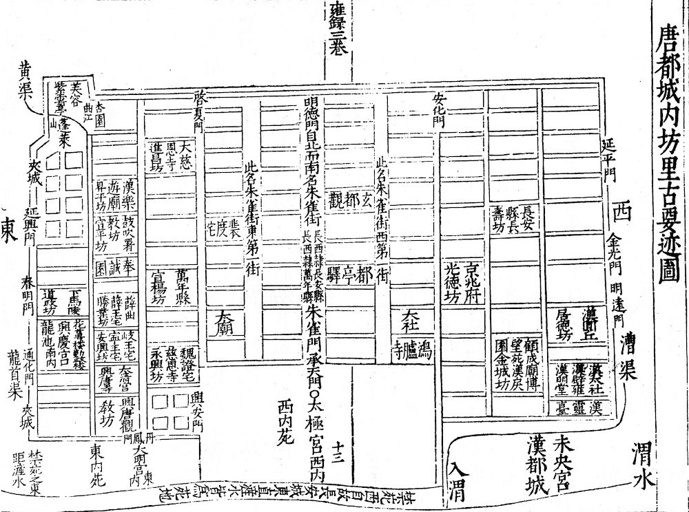
Figure 2. Urban quarters of Chang'an during the Tang period. Seen from the north. At the right bottom of the figure, the location of the ancient Han city is indicated. In the northern parts of the city (bottom), the Imperial Palace and Park is located. |
|
 |
|
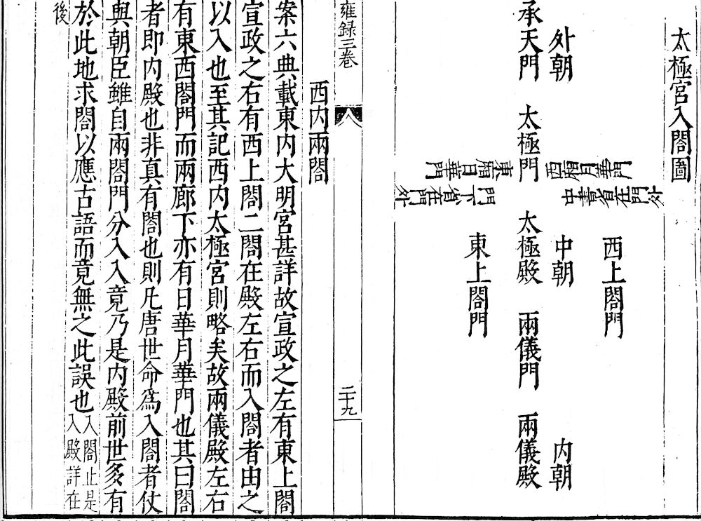
Figure 3. Arrangement of the Tang-period Taiji Palace, seen from the north. The Chengtian Gate 承天門 opens to the Outer Court (waichao 外朝), the Taiji Gate 太極門 to the Central Court (zhongchao 中朝) with the Taiji Hall 太極殿, and the Liangyi Gate 兩儀門 leads to the private Inner Court (neichao 内朝) with the Liangyi Hall 兩儀殿. The Palace Secretariat (zhongshusheng 中書省) was located west, the Chancellery (menxiasheng 門下省) east of the Central Court. |
|
 |
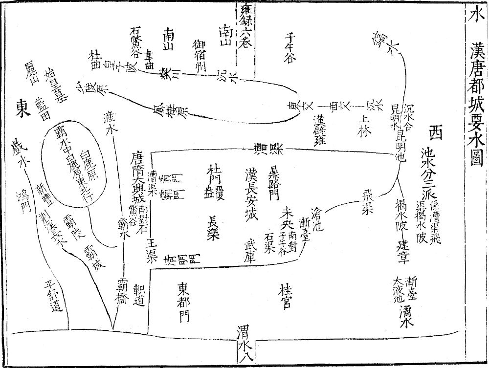 |
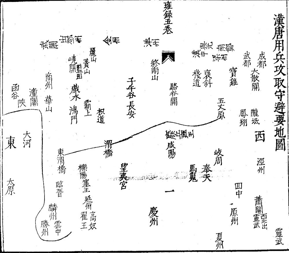
Figure 4. Large-scale defence strategy of Chang'an between the Yellow River Bend (left, east) and Chengdu in Sichuan (right top, southwest), showing important passes, mountains, and bridges. |
Figure 5. Canals and irrigation system of Chang'an during the Han and Tang periods. |
The Yonglu is rated as an excellent historiographic and literary book, but a lot of historical sources are missing because northern China was occupied by that time. It was nevertheless a very important base for later local gazetteers on that region written from the Ming period 明 (1368-1644) on. It is included in the series Gujin yishi 古今逸史, Siku quanshu 四庫全書 and Guanzhong congshu 關中叢書.